Dolomites Classic: Seiser Alm & Rosengarten
7 days / 6 nights
|


Starting point
Seis am Schlern / Ortisei
Finish point
Val di Fassa
Season
From June to September
Technical level
3/5
Fitness level
2/5
Tour type
Hut-to-Hut
from:
1.495 €
/person
.jpg&w=384&q=75)
Starting point
Seis am Schlern / Ortisei
Finish point
Val di Fassa
Season
From June to September
Technical level
3/5
Fitness level
2/5
Tour type
Hut-to-Hut
- Trek the most legendary and varied landscapes of the Dolomites
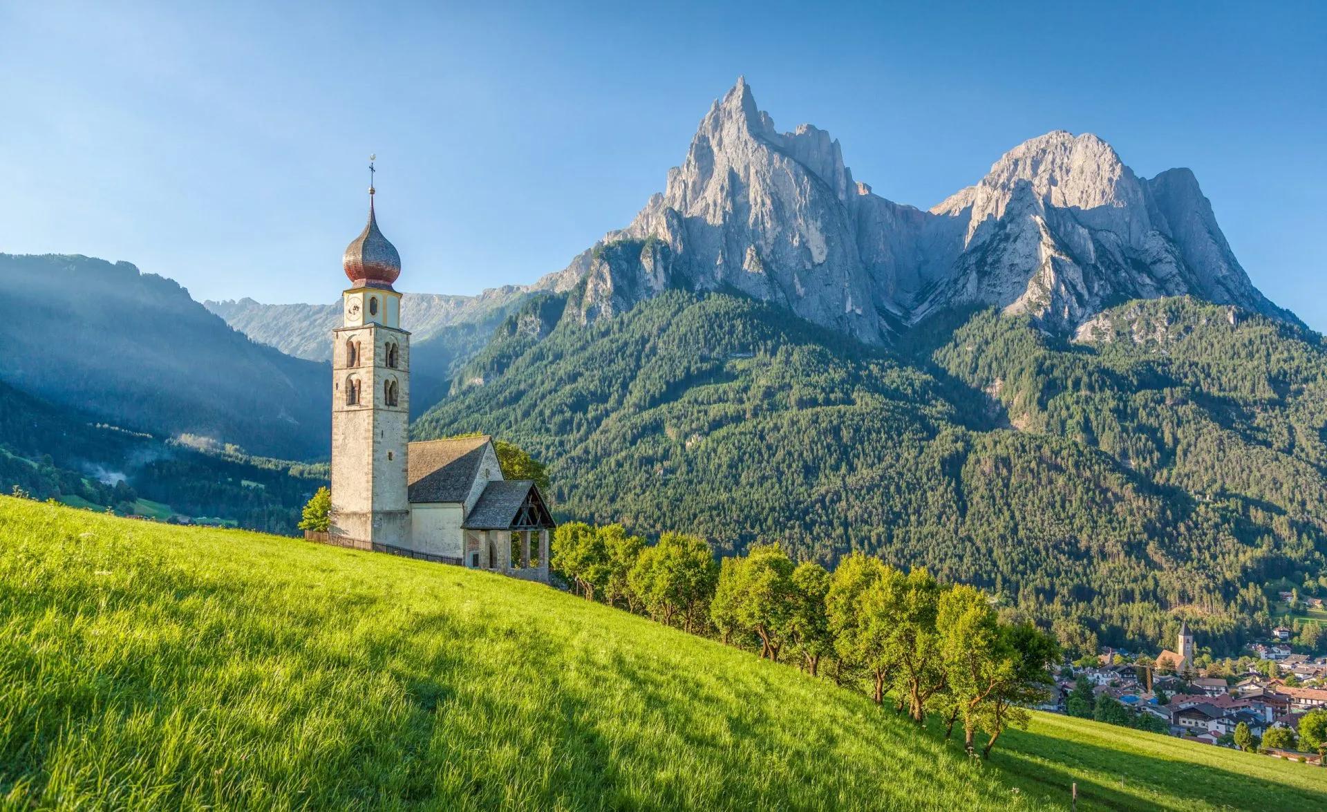
- Explore the Schlern-Rosengarten Nature Park, part of the UNESCO World Heritage Dolomites
- Hike across the picturesque Seiser Alm plateau and its green meadows dotted with wooden lodges
- Discover the myths of the Rosengarten mountain range and find King Laurin’s hidden rose garden
- Enjoy the epic views of the jagged Dolomites from the top of the Schlern Massif
- Stay at cozy mountain huts located in some of the most scenic spots
Itinerary of the trip


FREE ITINERARY
Get Your Travel Itinerary
Loved the itinerary? Enter your email below, and we'll send a copy straight to your inbox.
What’s included in the price?
Self-guided
NOT INCLUDED
OPTIONAL EXTRAS
What to bring to the tour
- Hiking shoes/boots
- 25 to 45-liter backpack
- Base layer
- Sports T-shirts
- Hiking shorts
- Hiking water-repellent pants
- Waterproof jacket
- Midlayer
- Sports socks and underwear
- Leisurewear for evenings
- Down jacket
- Gloves
- Shade hat/cap
- Warm headwear
- Sunscreen
- Sunglasses
- Headlamp
- Hiking poles
- ID card or passport
- Snacks
- Cash
- Water bottles or hydration pack
- Sleeping liner
- Toiletries
- Toilet paper
- Small first aid kit
Get ready to hike through the ultimate Dolomites experience — a hut-to-hut adventure that showcases the region’s most iconic and varied scenery. From the rolling alpine meadows of Seiser Alm to the towering peaks of the Schlern-Rosengarten range, this route offers an unbeatable mix of landscapes, legends, and views.
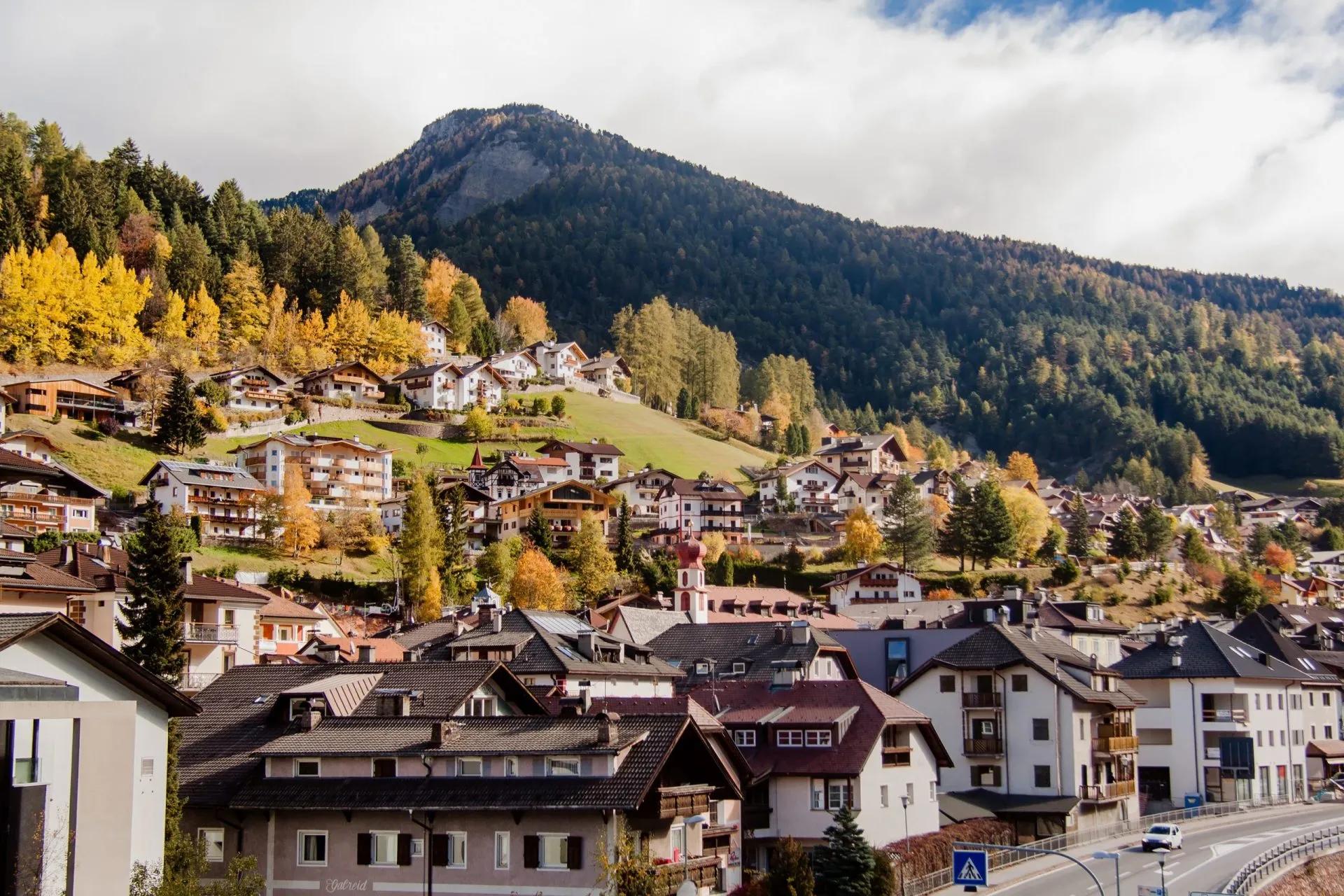
Your adventure begins with your arrival in Seis am Schlern, where you'll have the opportunity to explore the charming surroundings before setting off on your hike. Over a week, you'll traverse the Seiser Alm plateau, ascend the Schlern Massif, hike around the iconic Langkofel group, and venture deep into the heart of the Rosengarten mountains. The tour culminates in a descent through a picturesque forest, bringing you to your final destination in Val di Fassa.
Throughout your journey, you'll have the opportunity to stay in authentic mountain huts, or rifugios, nestled high up in the Alps. These cozy lodges offer a warm atmosphere, comfortable accommodations, and mouthwatering homemade South Tyrolian dishes to recharge your energy after a long day of hiking.
Our hut-to-hut tour is designed to provide you with a seamless and enjoyable experience. We take care of all rifugio bookings, ensuring that you have a comfortable place to rest each night. To keep you on track, we equip you with a precise GPS track of the planned route, as well as a detailed written itinerary that includes daily highlights and points of interest.
Don't miss out on this incredible opportunity to explore the enchanting landscapes of the Dolomites on our Seiser Alm & Schlern-Rosengarten hike. Inquire about the adventure today and experience the magic and beauty of this legendary region.
Frequently Asked Questions
Ratings & Reviews

5.0 average rating


We had a lovely hike today with our guide Klemen. He personalized the tour on our needs and interests, so that we saw places we wouldn't without his experience. The hike was a little bit slippery after the rain from the last days and it went a lot upwards, but it was totally worth it! Thanks again :)


Well organized trip. The travel agents were extremely communicative, provided great service, and made adjustments as needed. The GPS app provided was another highlight. It worked exceptionally well made the trek much easier. The itinerary was thorough and included lots of extra details about the region as well as scaling options. The only drawbacks were that the company is based in Slovenia (doesn't seem to have a presence in South Tyrol), and the cost, which was higher than similar treks from competitors.

Karin Boychyn
his was an amazing trip and we got a lot of valuable information from the agents at huttohuthiking which made it all very easy. We would definitely book another trip through them.


All available guidance options
Self-guided
Those who like a good adventure and limitless flexibility should go on a self-guided tour. We prepare the itinerary and book your accommodations while you enjoy the journey without our guide, being fully in charge of all the daily decisions. While you’ll have the full support of our team in case of any emergencies or concerns, a certain level of self-reliance is required.

Hassle-Free
We handle itineraries, accommodations, and anything else you prefer not to deal with, so you can enjoy a carefree hike.

Book with confidence
We are a financially protected company, fully bonded and insured, keeping your money safe and allowing you to travel with confidence.

Tried & Tested Adventures
Only the best hut to hut hikes in the Dolomites, cherry-picked by our local team with an in-depth knowledge of the region.

Unbeatable support
Our 24/7 customer support is where we show our passion, bringing you a better experience by making your well-being our number one priority.
.jpg&w=3840&q=75)