6.4 km and 930 m of elevation gain / 100 m of elevation loss


1/10
Show all 10 photos
Alta Via 1 Self-Guided Hike
10 days / 9 nights
|
Explore the breathtaking Dolomites, Italy’s most captivating mountain range, on a self-guided hut-to-hut hike along the iconic Alta Via 1 alpine trail.
Explore the breathtaking Dolomites, Italy’s most captivating mountain range, on a self-guided hut-to-hut hike along the iconic Alta Via 1 alpine trail.
Explore the breathtaking Dolomites, Italy’s most captivating mountain range, on a self-guided hut-to-hut hike along the iconic Alta Via 1 alpine trail.
Highlights
- Complete the famous Alta Via 1 hut-to-hut hiking trail in its entirety across nine days
- Hike through the most picturesque places in the Dolomites
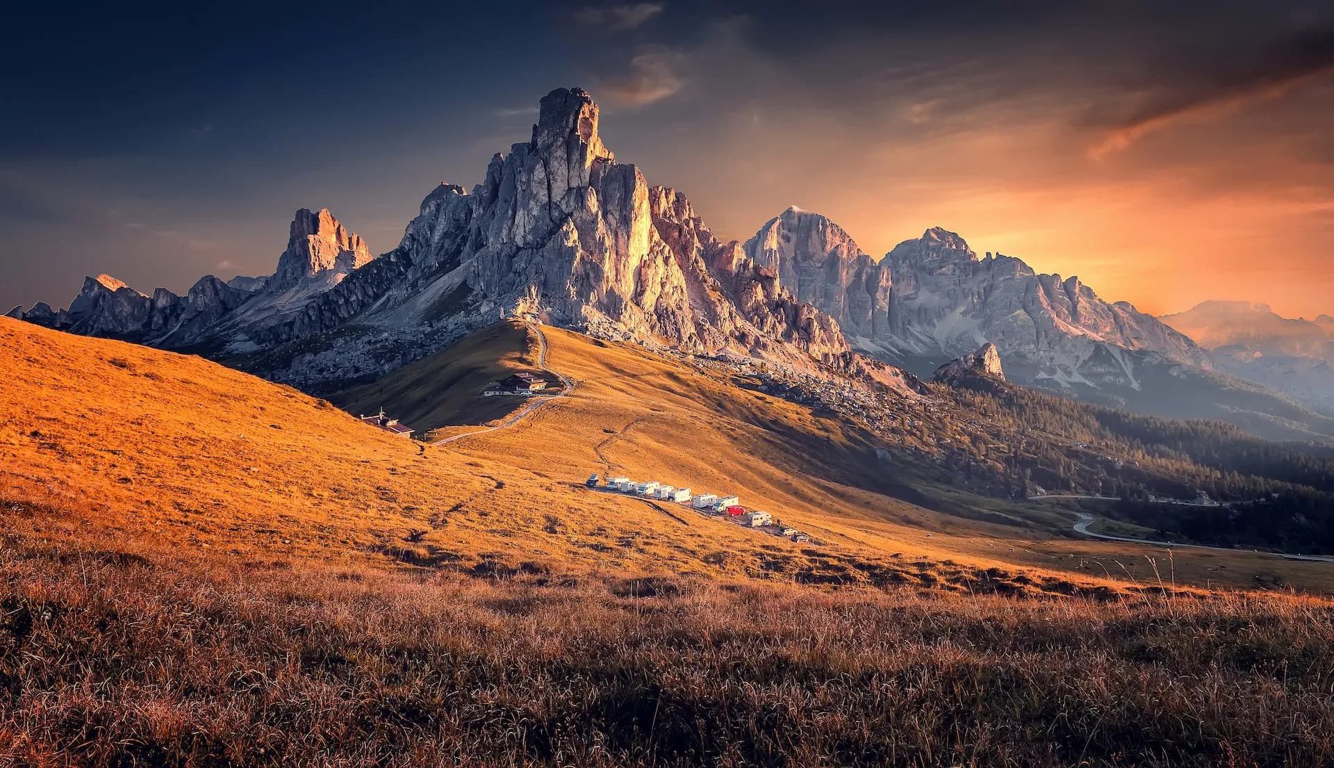
- Visit two iconic mountain passes above Cortina d’Ampezzo – Passo Giau and Falzarego Pass
- Sleep in authentic ‘rifugios’ and enjoy the traditional local cuisine
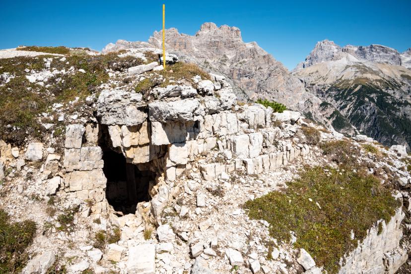
- Discover World War I remnants
What’s included in the price?
Self-guided
Are you looking for a good adventure and limitless flexibility? Then you should try out a self-guided tour, perfect for independent explorers who want to set their own pace. Without the need to stick to a group schedule, you’re free to linger at scenic viewpoints while the logistics are taken care of in advance.
INCLUDED
9 nights in (mountain) huts with half-board
Digital guidebook with itinerary, route instructions, and practical information
GPS navigation with an easy-to-use app
Tour design and organization
Service and support during your hike
NOT INCLUDED
Tourist tax
OPTIONAL EXTRAS
Additional transfers
Airport transfer
Airport transfer from Venice Airport to Cortina d'Ampezzo
Extra nights
Private rooms
Transfer from Cortina d'Ampezzo to Starting Point
Accommodation levelBasic
Mountain huts, refuges, and dormitory-style guesthouses with mostly shared rooms and facilities, and half-board meals are normally included. Facilities are simple and rustic — expect limited or no showers, a limited water supply, and a straightforward environment due to restricted accessibility in remote locations.
These are examples of the type and standard you can expect. Actual properties may vary depending on availability.
What to bring to the tour
- Hiking shoes/boots
- 25 to 45-liter backpack
- Base layer
- Sports T-shirts
- Hiking shorts
- Hiking water-repellent pants
- Waterproof jacket
- Midlayer
- Sports socks and underwear
- Leisurewear for evenings
- Down jacket
- Gloves
- Shade hat/cap
- Warm headwear
- Sunscreen
- Sunglasses
- Headlamp
- Hiking poles
- ID card or passport
- Snacks
- Cash
- Water bottles or hydration pack
- Sleeping liner
- Toiletries
- Toilet paper
- Small first aid kit
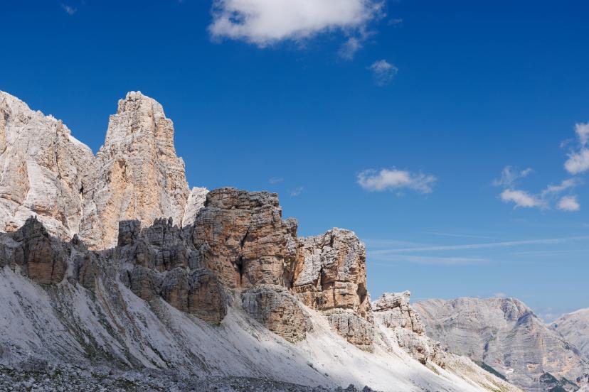
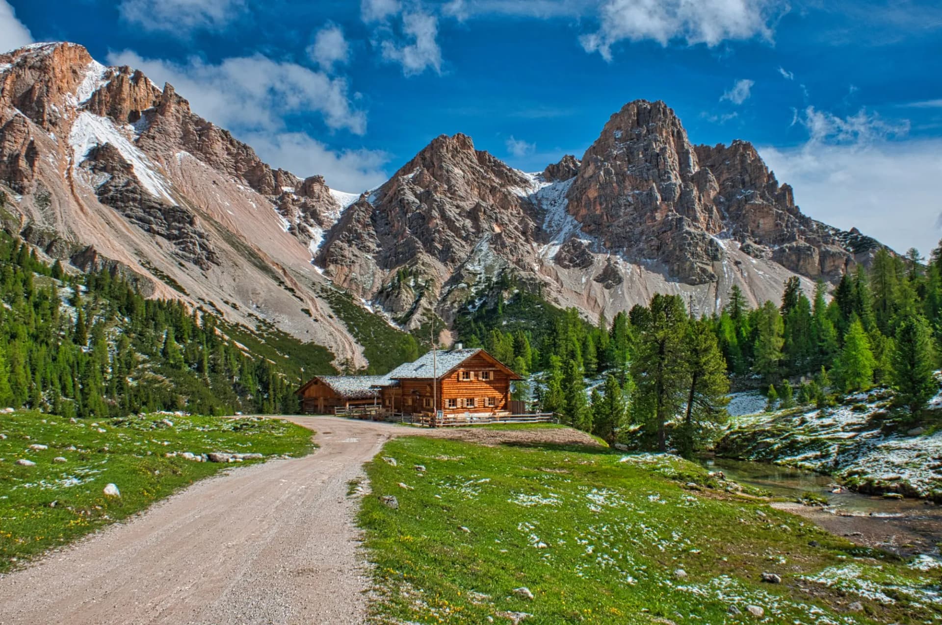
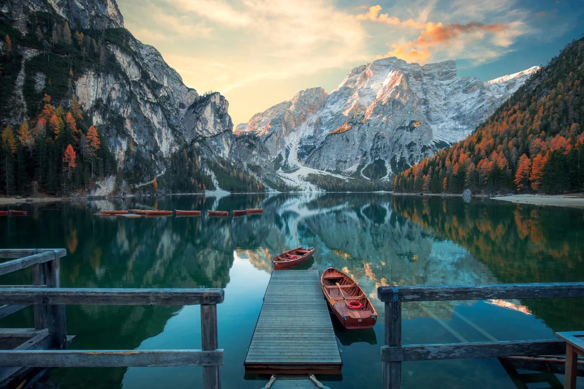
The Alta Via 1 trail that passes through the Dolomites showcases Italy's most beautiful mountain scenery. The landscape is known for its abnormal natural beauty and somewhat dark history. Many scenic places, such as the Falzarego mountain pass, bear the scars of World War I battles.
Unlike its sister, Alta Via 2, it is appropriate for every regular hiker, overcoming 120 kilometers and 6700 meters of elevation across nine stages. From its beginning at Lago di Braies to its conclusion in La Stanga, Alta Via 1 feels like an experience that transcends everything you thought was possible.
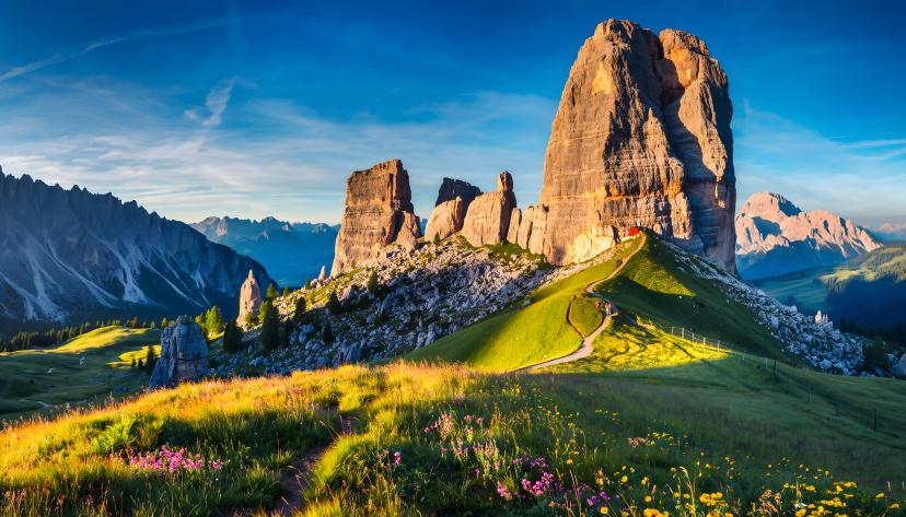
From the scenic alpine meadows at Passo Giau to the redoubtable face of Monte Civetta and rock-formed towers of Cinque Torri, a hiker can be afraid to blink lest they miss something.
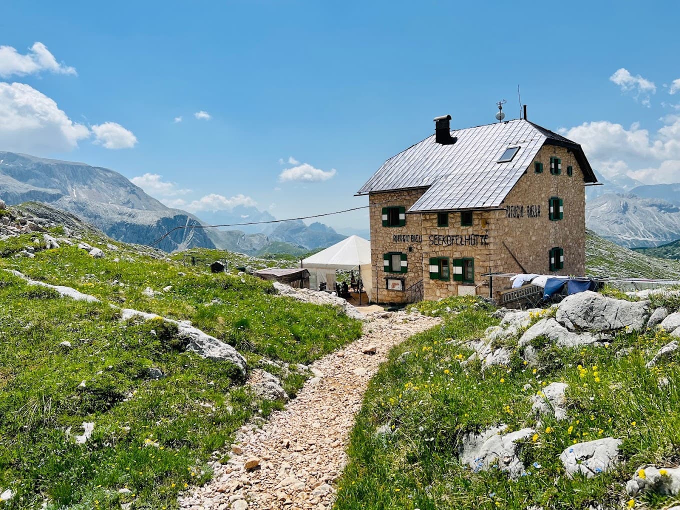
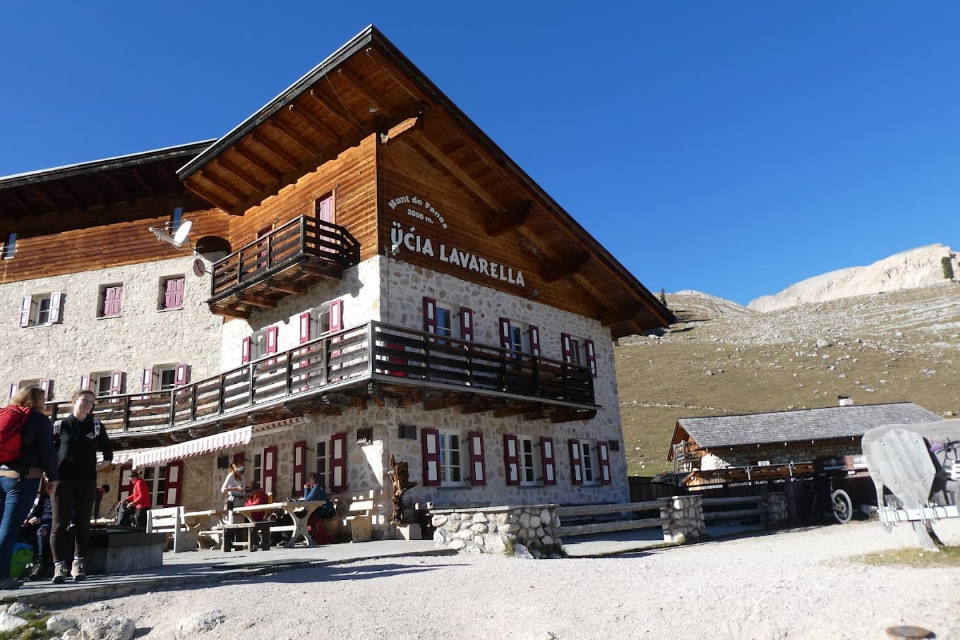
On Alta Via 1, hikers often walk well away from civilization, meaning your only chance of experiencing the trail as you should, is by sleeping in the mountain huts along the way. Or, as Italians call them, 'rifugios'.
An authentic mountain lodge high up in the Alps with homemade Italian dishes and enough comfort for a good night’s sleep – what more could a tired trekker seek? Our Alta Via 1 hut-to-hut tour includes all rifugio bookings, and we equip you with a precise GPS track of the planned route.
You will not miss any landmarks either, as our digital guidebook with the itinerary includes a highlights section for every day. If you feel like you would still prefer a guide by your side, you can check out out Alta Via 1 - Guided Hike.
Reinhold Messner once said that every mountain in the Dolomites is like a piece of art. And to say he saw many is an understatement. Is that really something you can afford to miss during your lifetime?
For those who find themselves a bit short on time, we've also created an Alta Via 1 Highlights tour to ensure you can walk the best of this iconic trail in only 4 days!
Frequently Asked Questions

Hassle-Free
We handle itineraries, accommodations, and anything else you prefer not to deal with, so you can enjoy a carefree hike.

Book with confidence
We are a financially protected company, fully bonded and insured, keeping your money safe and allowing you to travel with confidence.

Tried & Tested Adventures
Only the best hut to hut hikes in the Dolomites, cherry-picked by our local team with an in-depth knowledge of the region.

Unbeatable support
Our 24/7 customer support is where we show our passion, bringing you a better experience by making your well-being our number one priority.
from 1.790 € /person