Which Alta Via is Best? Your Guide to Choosing the Perfect Trail
From beginner-friendly classics to expert-only expeditions—discover which Alta Via route matches your hiking style, fitness level, and mountain dreams.

Ajda
Published December 3, 2025
Edited December 16, 2025
18 min read
Quick links
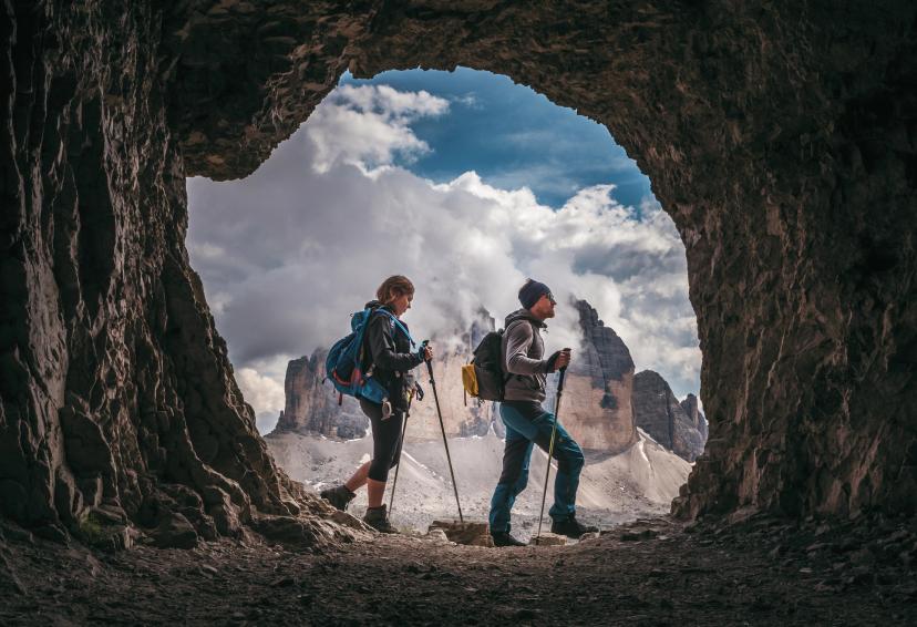
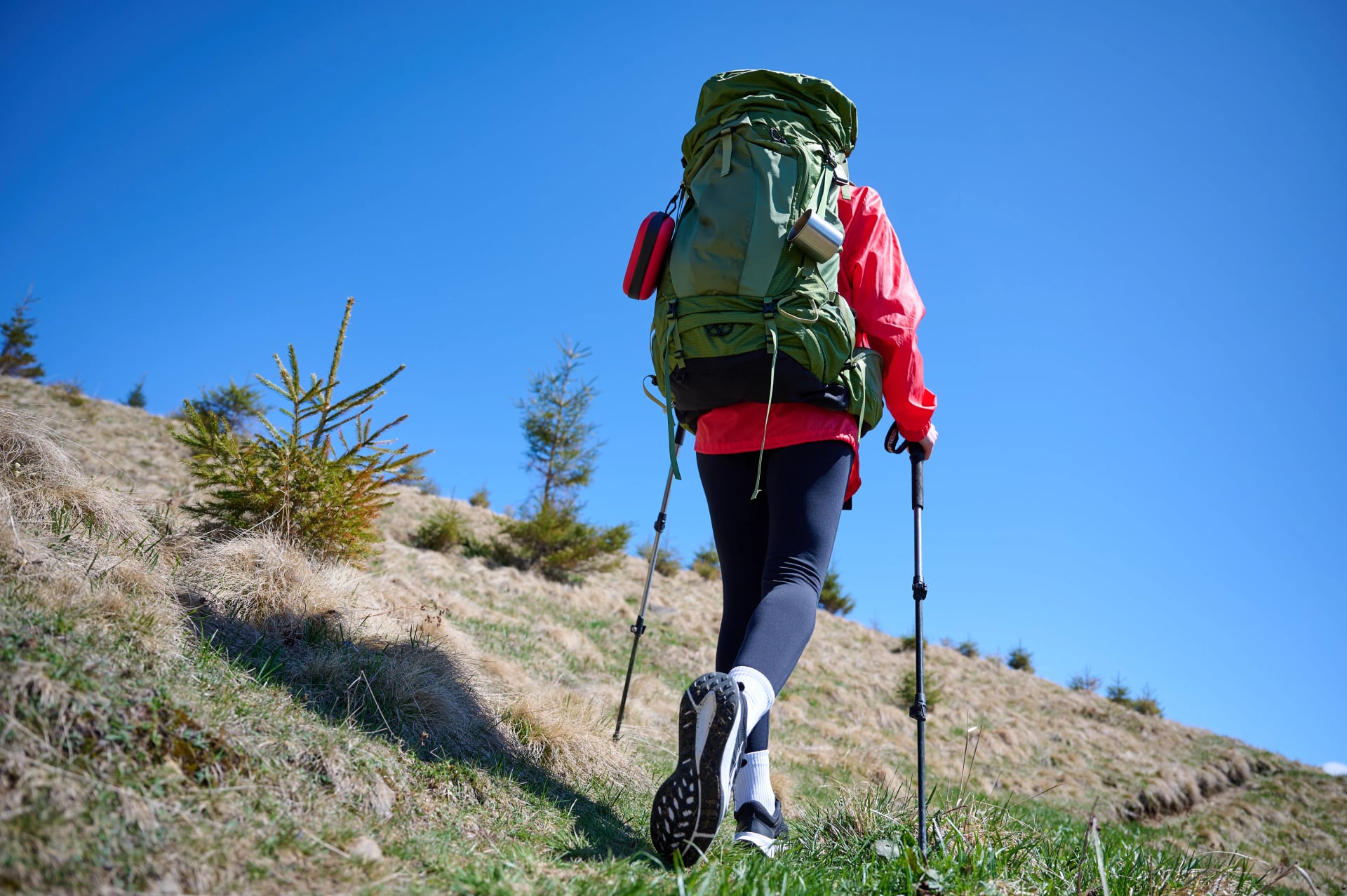
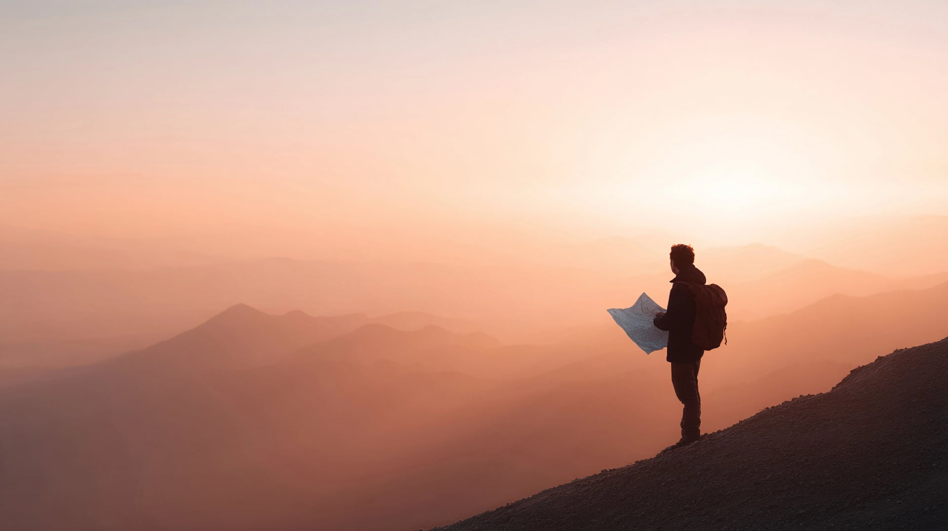
Standing at the trailhead with a map of the Dolomites spread before you, you're faced with an enviable dilemma: ten incredible Alta Via routes, each promising unforgettable mountain experiences. But which one is right for you?
The truth is, there's no single "best" Alta Via—only the best one for your experience level, fitness, time available, and what you're hoping to discover in these UNESCO-protected peaks. Whether you're drawn to the iconic scenery of Alta Via 1, the wild challenge of Alta Via 2, or the quieter paths less traveled, this guide will help you choose your perfect Dolomites adventure.

We've guided hundreds of hikers through these legendary trails, and we know exactly what makes each route special—and which one will leave you with the mountain memories you're dreaming of.
Understanding the Alta Via Network
What Are the Alta Vias at a Glance?
Total routes: 10 numbered long-distance trails across the Dolomites
Created: 1960s–1970s, linking existing paths into multi-day journeys
Length range: 80–180 km depending on route
Duration: 5–16 days (most routes 7–14 days)
Difficulty spread: Easy meadow walks (AV6) to technical mountaineering (AV2)
Season: Late June to mid-September (rifugios open, trails snow-free)
Most popular: Alta Via 1 (iconic scenery, accessible) and Alta Via 2 (expert challenge)
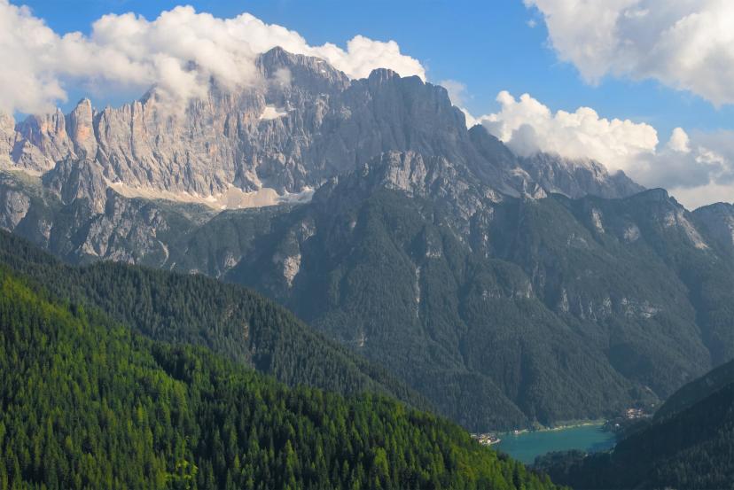
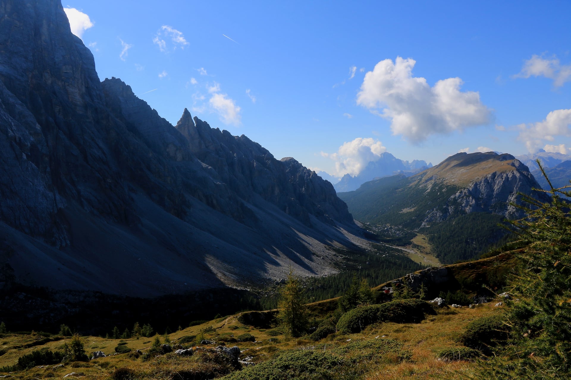
The Alta Vias (Italian for "High Routes") are a network of ten numbered long-distance hiking trails that weave through the heart of the Dolomites. Created primarily in the 1960s and 1970s, these routes weren't carved from scratch—instead, they cleverly connected existing paths, shepherds' trails, and World War I military routes into coherent multi-day journeys.
Each Alta Via was designed with a specific character and purpose. Some follow dramatic ridgelines past the most famous peaks. Others explore quieter valleys and lesser-known massifs. Together, they form one of Europe's most celebrated hiking networks, offering everything from gentle introductions to high-alpine adventures that test even experienced mountaineers.
Most Alta Vias take 7 to 16 days to complete, though many hikers choose to tackle shorter sections. The routes generally run north to south (or vice versa) and are marked with the distinctive red-white-red blazes you'll find throughout the Alps, plus specific Alta Via numbering.
How the Alta Vias Differ

Not all Alta Vias are created equal. Here's what varies:
Difficulty levels: Technical demands range from straightforward hiking (AV6) to serious mountaineering with via ferrata sections and exposed scrambling (AV2). Fitness requirements also vary—some routes involve 1,200+ meters of elevation gain daily, while others offer gentler profiles.
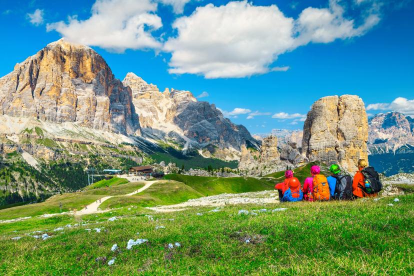
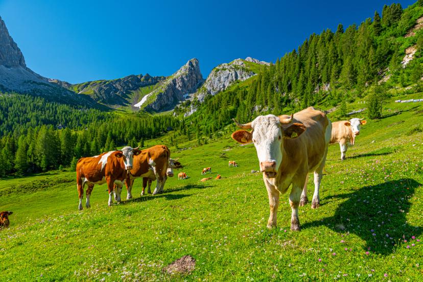
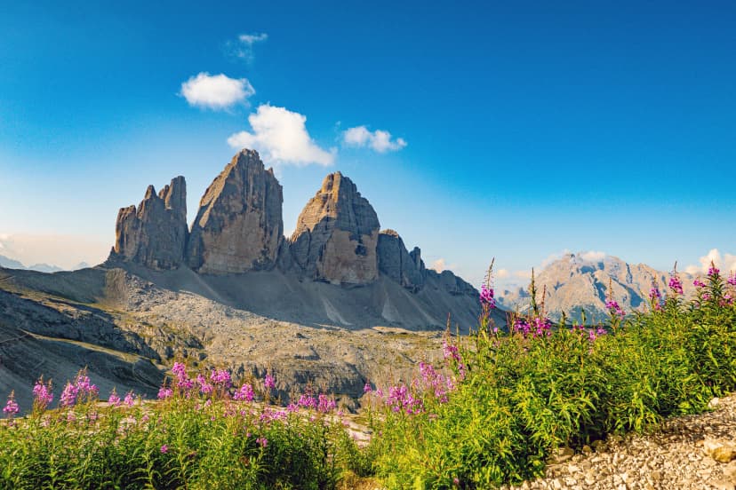
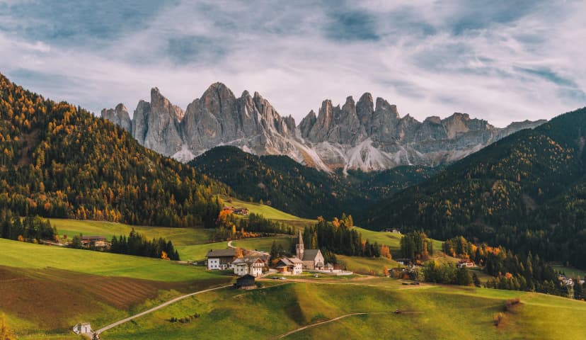
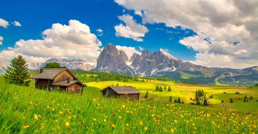
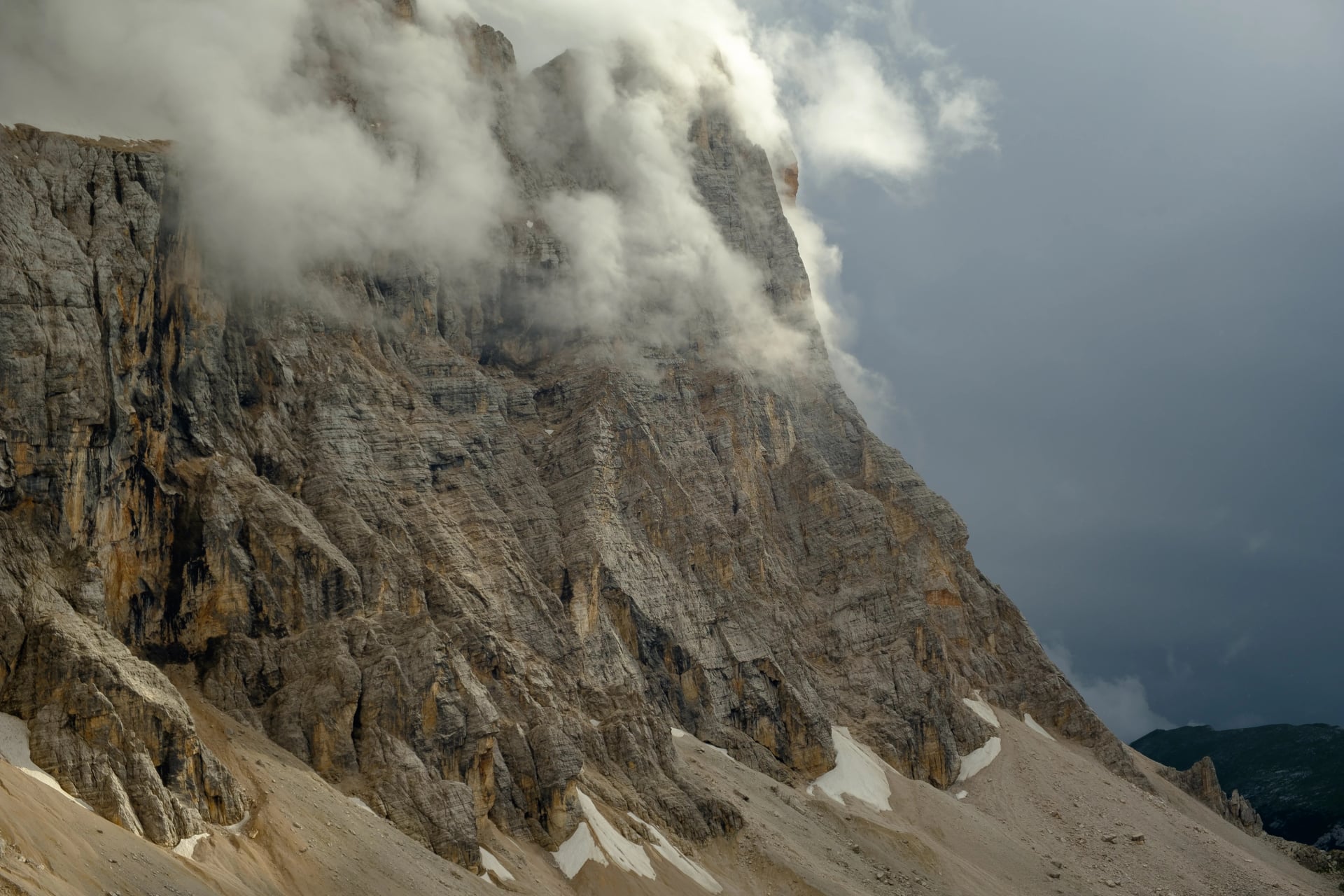
Scenery types: Alta Via 1 showcases the Dolomites' most iconic peaks—those dramatic spires you've seen in photographs. Alta Via 2 crosses wilder, more remote terrain. Routes 6 and 7 wind through alpine meadows and traditional farming valleys. Each has its own visual personality.
Infrastructure: Rifugio (mountain hut) spacing differs significantly. On popular routes like AV1, you'll find well-equipped huts every 4-6 hours of hiking. On remote sections of AV10, you might have longer stretches with fewer services.
Crowds: Alta Via 1 is the Dolomites' most popular long-distance trail, especially in July and August. By contrast, you might go days without seeing another hiker on parts of Alta Via 7 or 10.
Want to understand what to expect from mountain hut life and how to prepare for any Alta Via? Our Ultimate Guide to Hiking in the Dolomites covers everything from fitness prep to packing lists.
Alta Via 1 vs Alta Via 2: The Classic Debate
These two routes dominate the conversation when hikers ask "which Alta Via is best?"—and for good reason. They're the most famous, most documented, and most representative of what makes the Dolomites spectacular. But they offer very different experiences.
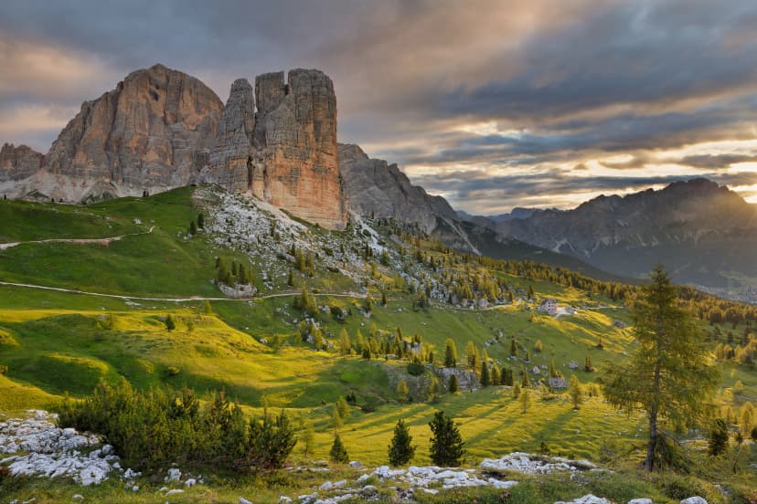
Alta Via 1 - The People's Favorite
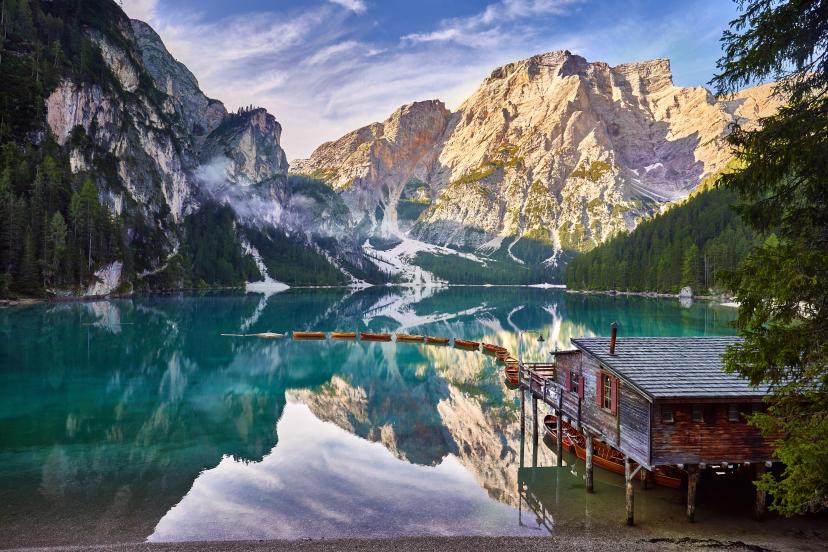
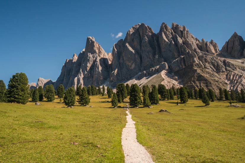
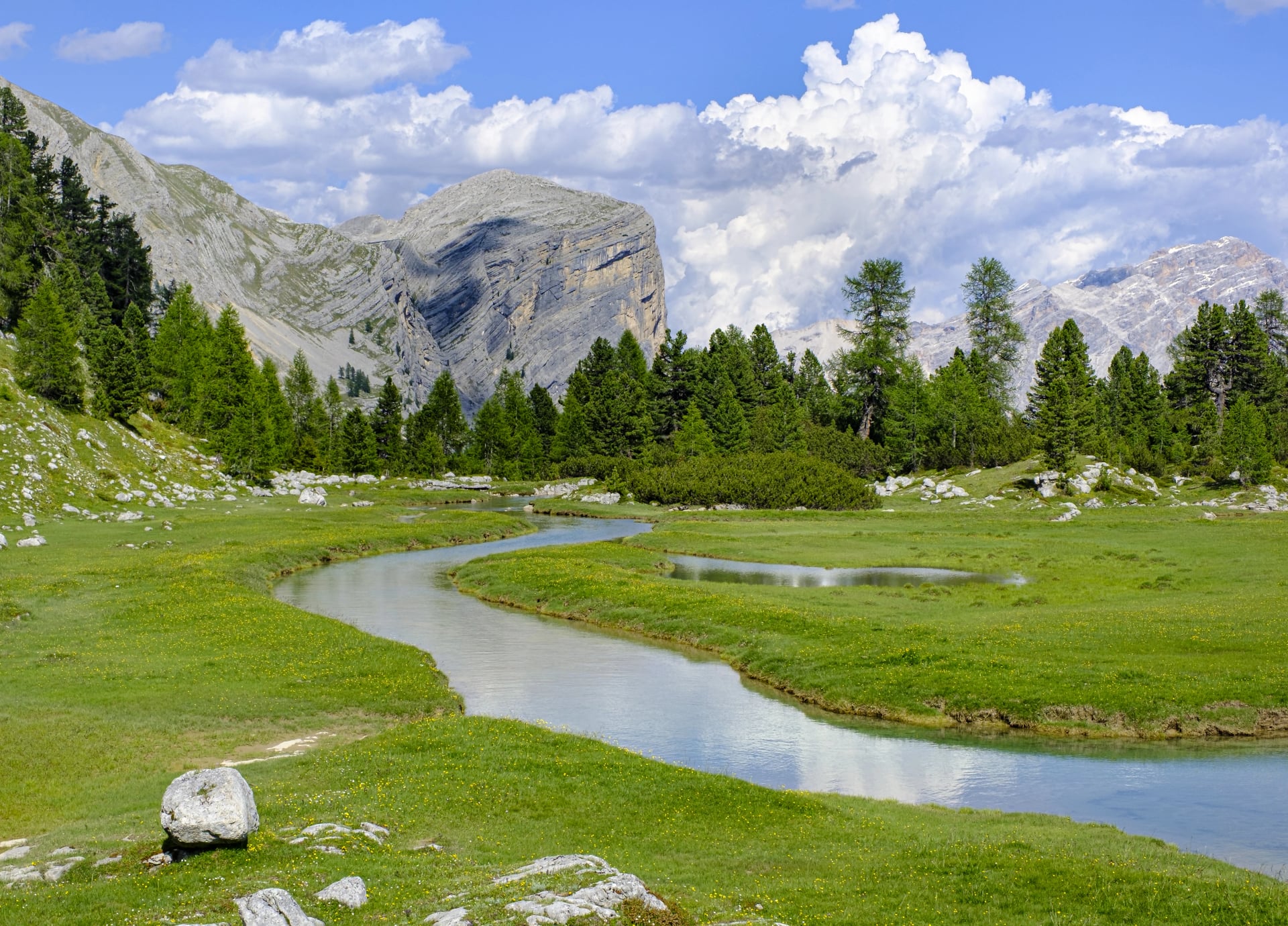
Running approximately 120 kilometers from Lago di Braies to Belluno, Alta Via 1 is often called the most beautiful long-distance trail in Europe—and it lives up to the hype.
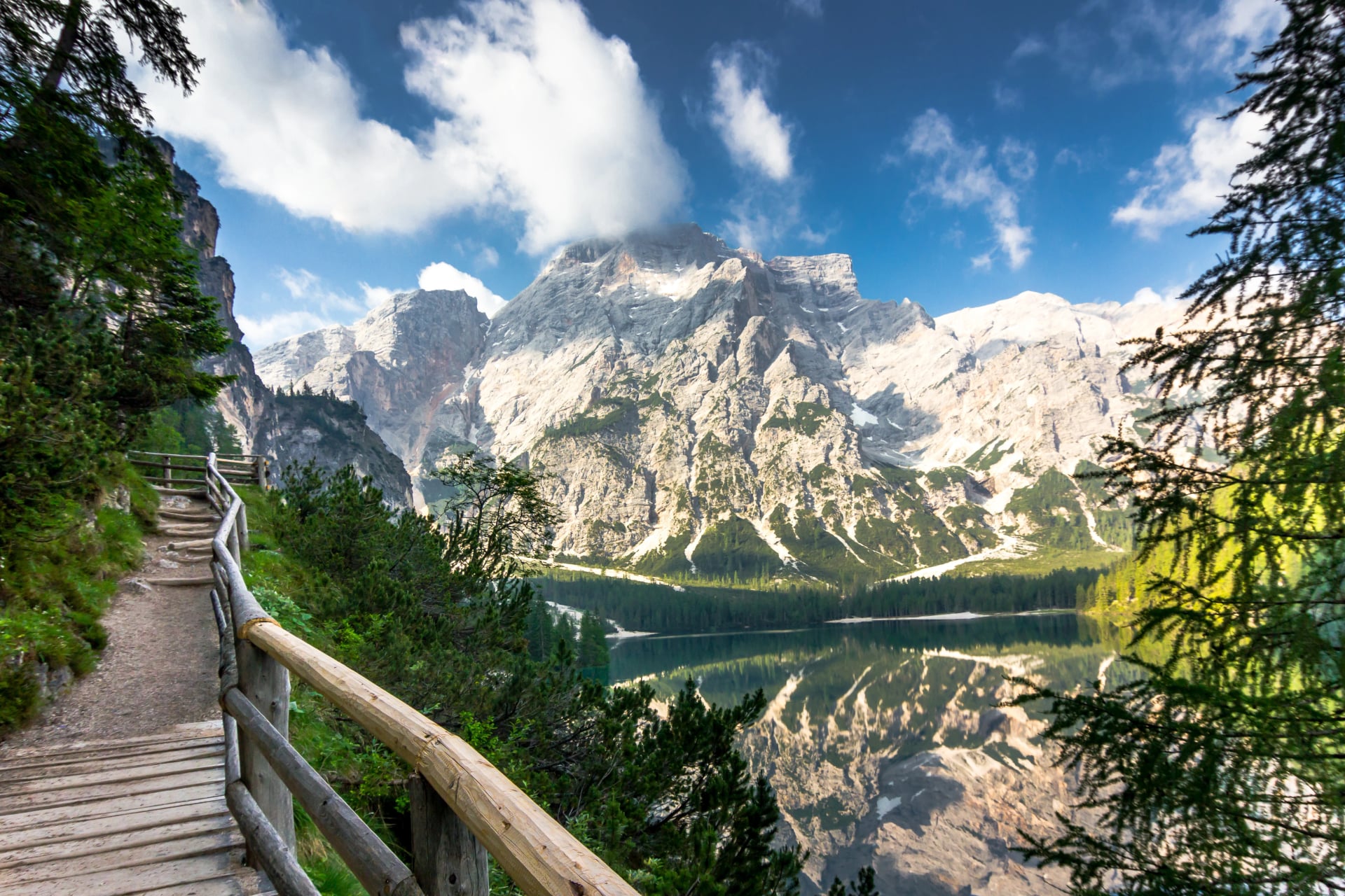
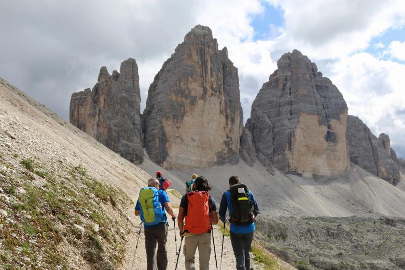
Why it's beloved: This route passes beneath some of the Dolomites' most photographed peaks: the Tofane, Nuvolau, Averau, Civetta, and Pelmo. You'll hike through wildflower meadows with postcard views, cross high passes with 360-degree panoramas. The trail is exceptionally well-maintained and clearly marked, making navigation straightforward.
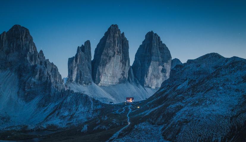
Best sections: The stretch from [Lagazuoi] through the Nuvolau group offers jaw-dropping scenery at every turn. The approach to Rifugio Coldai beneath Civetta's northwest face is one of the most dramatic in the Alps. And the final days through the Pala group deliver a satisfying crescendo.
Technical level: 2-3/5. Most of the route follows good mountain paths with some rocky sections and occasional exposure. A few short via ferrata passages (all optional) add spice for those who want it. No climbing skills required, but you should be comfortable with heights and uneven terrain.
Fitness level: 2-3/5. Expect daily elevation gains of 800-1,200 meters and 5-7 hours of hiking. It's a workout, but most moderately fit hikers handle it well with proper acclimatization.
Who should hike it: First-time Alta Via hikers, photographers wanting classic Dolomites shots, families with teenagers, anyone seeking the quintessential Dolomites experience without extreme difficulty.
Typical duration: 10-12 days for the full route, though many hikers complete shorter sections in 5-7 days.
What you will see on the route:
The reason Alta Via 1 consistently tops "best of" lists isn't just its scenery—it's the perfect balance of challenge and accessibility. You'll feel like a mountaineer without needing mountaineering skills.
Experience the best of Alta Via 1 on our tours:
Alta Via 2 - The Connoisseur's Choice
If Alta Via 1 is the Dolomites' greatest hits album, Alta Via 2 is the deep cut for serious fans. Running roughly 160 kilometers from Brixen to Feltre, this route demands more and gives more in return.

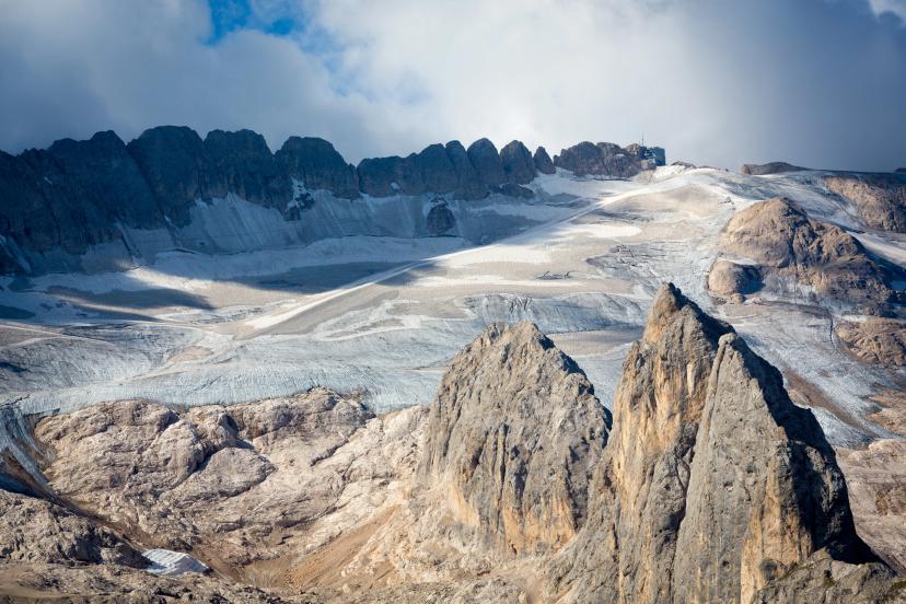
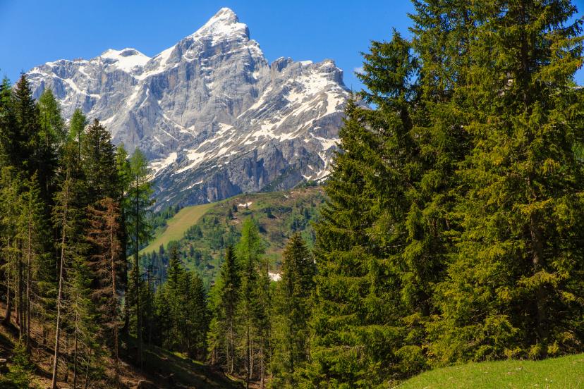
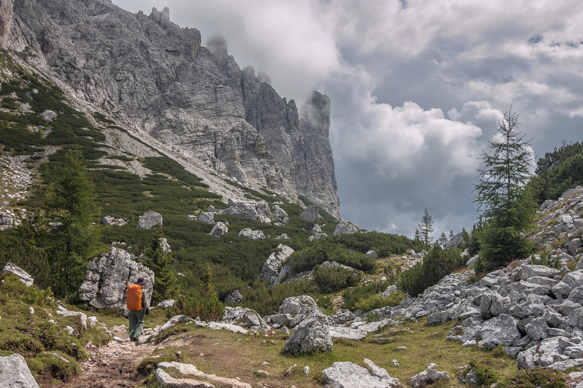
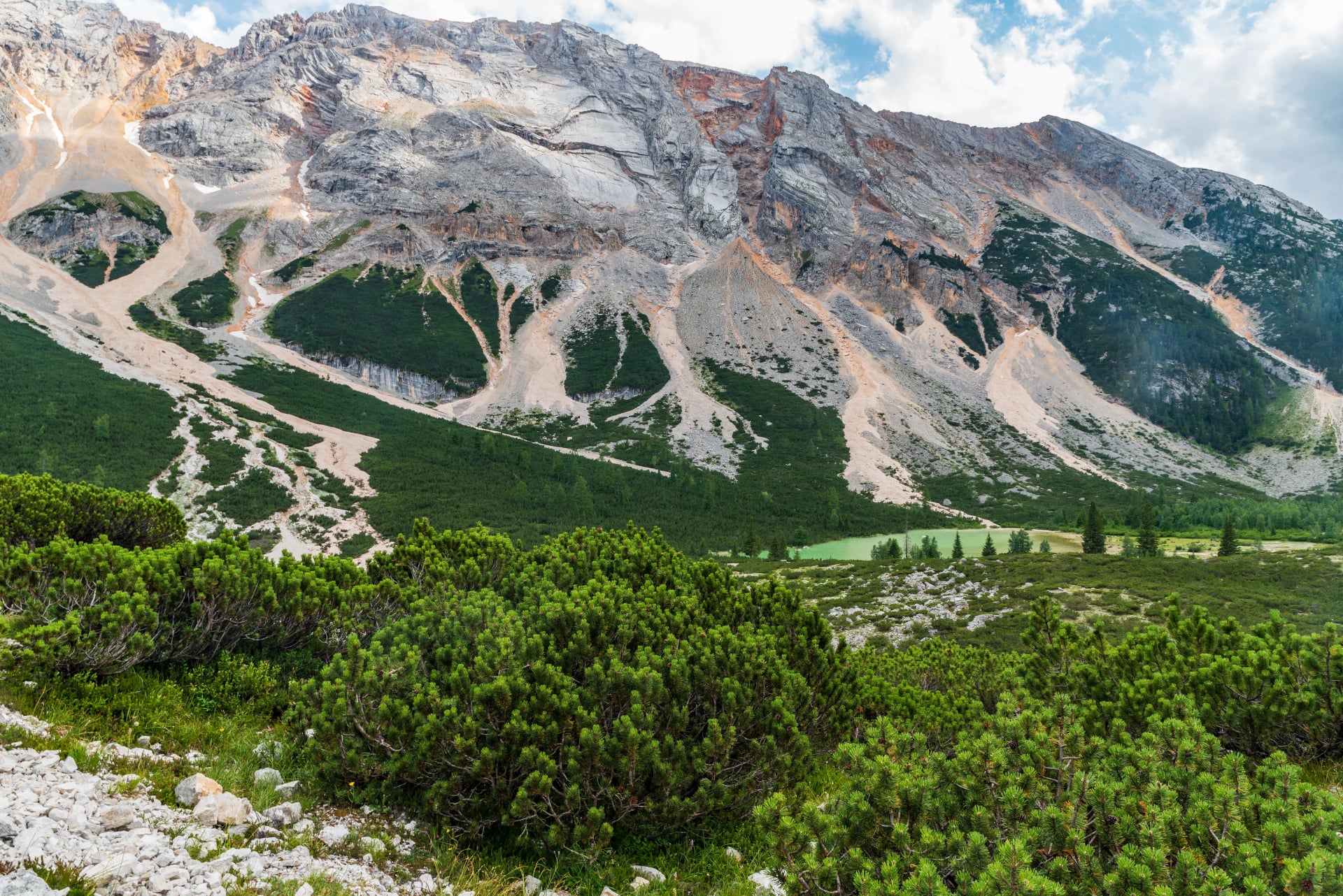
Why it's special: Alta Via 2 ventures into wilder, more remote territory. You'll traverse the Pütia and Sella groups, climb beneath the Marmolada glacier (the Dolomites' highest peak at 3,343m), and cross terrain where chamois outnumber hikers. The landscapes are more varied—one day you're in flower-filled meadows, the next you're crossing stark lunar plateaus of pale limestone.
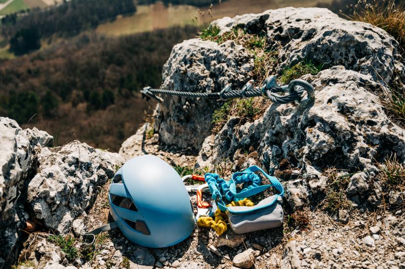
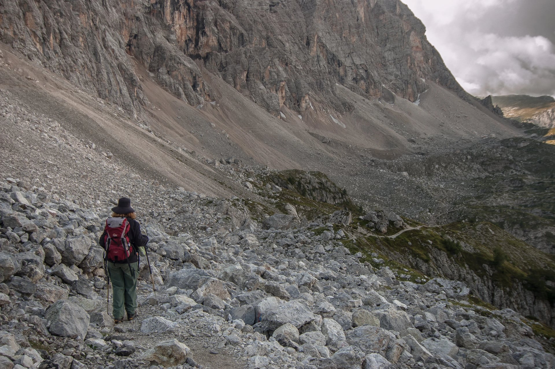
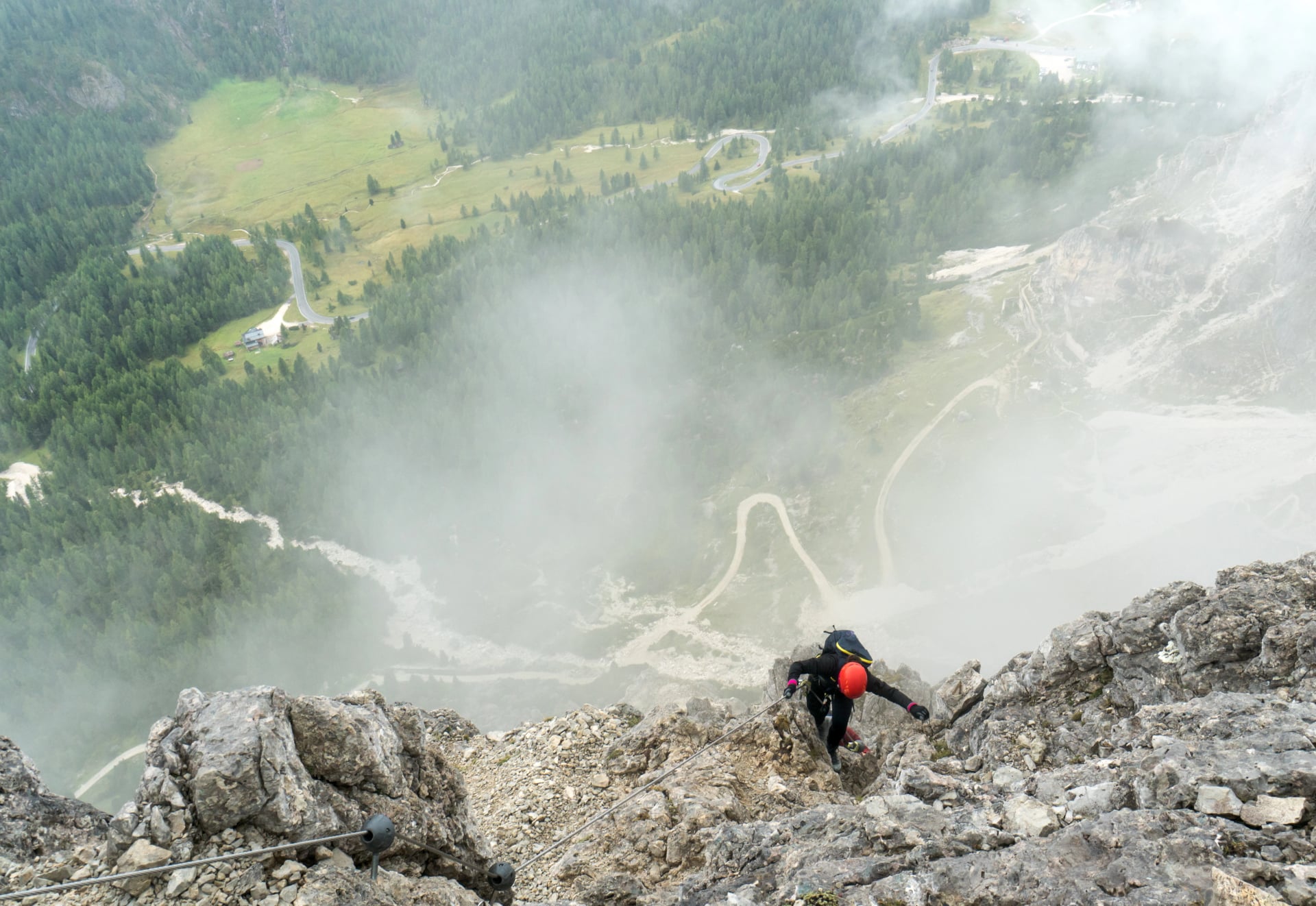
Technical challenges: This is where AV2 separates itself. Several sections involve via ferratas (iron-cable-assisted climbing routes) that aren't optional—they're the only way through. You'll encounter sustained exposure, loose rock, and routes where a slip would have consequences. The Sella Towers traverse and sections of the Marmolada Group demand respect and sure footing.
Technical level: 5/5. Via ferrata experience strongly recommended. You'll need harness, helmet, and via ferrata set. Some sections approach basic mountaineering.
Fitness level: 4/5. Longer daily stages (6-9 hours), bigger elevation gains (1,000-1,500m), and more sustained climbing than AV1.
Who should hike it: Experienced mountain hikers who've completed routes like AV1 or similar multi-day treks. Those comfortable with exposure and via ferratas. Adventurers seeking remoteness and challenge.
Typical duration: 13-16 days, with less flexibility to shorten sections due to more limited rifugio access.
Highlights on the way:
Alta Via 2 rewards those who come prepared. The sense of accomplishment at the finish is immense—you've tackled one of the Alps' most demanding multi-day routes.
Experience this route guided or self-guided on our tour:
Alta Via 1 or Alta Via 2?
Choose Alta Via 1 if:

It's your first Alta Via or first serious mountain trek
You want stunning scenery without technical climbing
You prefer well-spaced rifugios and reliable infrastructure
You're hiking with less-experienced partners
You value flexibility to shorten or adjust your route
Choose Alta Via 2 if:
You've already hiked AV1 or similar challenging routes
You're comfortable on via ferratas and exposed terrain
You crave remoteness and fewer crowds
You're physically fit and mentally prepared for long days
You want to push your limits in spectacular surroundings
Still trying to decide? Book a meeting with us—we can discuss your experience and help you choose the right route.
The Complete Alta Via Collection
While Alta Vias 1 and 2 grab the headlines, the other eight routes offer their own compelling reasons to lace up your boots. Here's what makes each special:
Alta Via 3
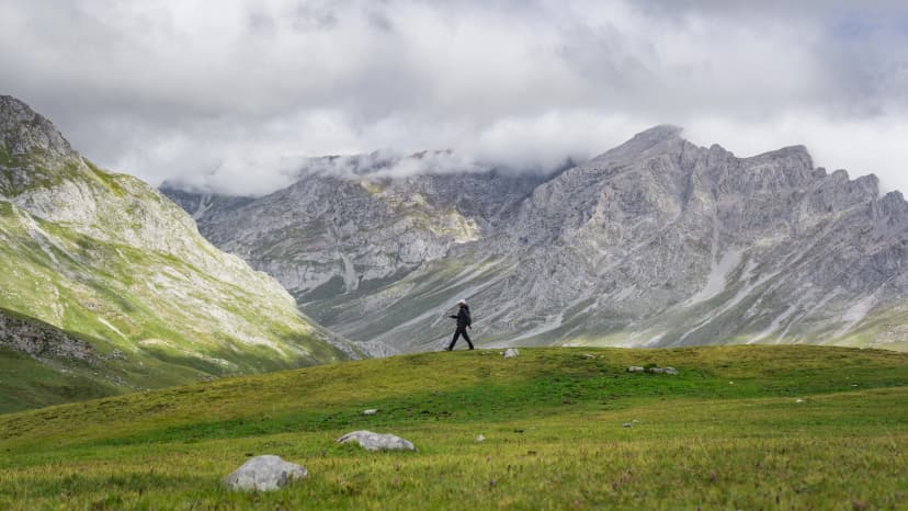
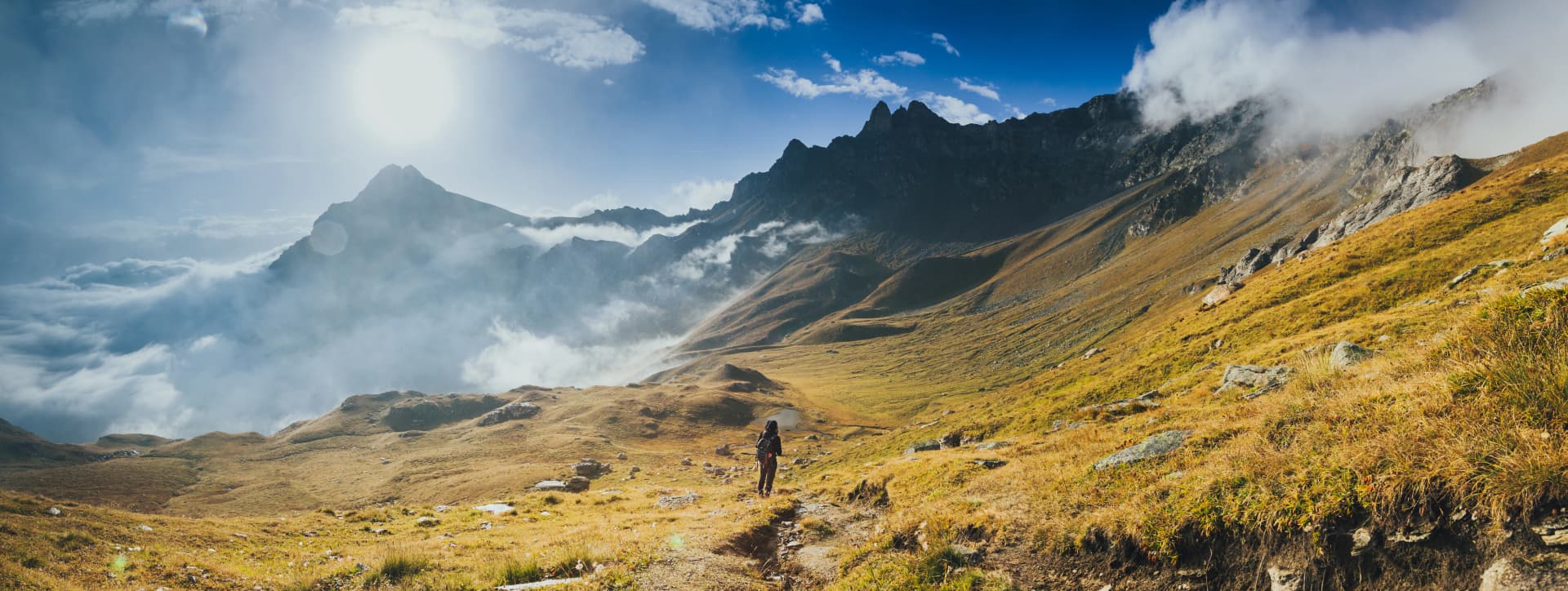
Alta Via 3, the Alta Via dei Camosci (Old Way of the Chamois), is one of the wildest long-distance routes in the Dolomites, threading through remote basins, karst plateaus, and sparsely serviced high terrain. Its stages are long, committing, and shaped by rugged limestone architecture that requires steady legs and reliable navigation.
Length: ~120 km
Elevation Gain: ~7,000 m
Time to Complete: 6–8 days
Fitness Level: 4/5 (long daily ascents and limited resupply points)
Technical Difficulty: 4/5 (exposed terrain, fixed cables, rough rock underfoot)
Best for: experienced hikers seeking remote, rugged terrain with a wilder, less-trafficked atmosphere.
Alta Via 4
Alta Via 4 traverses some of the Dolomites’ most dramatic high ridges between the Sesto group and the Marmolada region. It includes multiple via ferrata segments and sustained high-altitude travel, delivering exceptional scenery but requiring confident movement on steep, equipped terrain.
Length: ~85 km
Elevation Gain: ~6,000 m
Time to Complete: 5–7 days
Fitness Level: 4/5 (continuous elevation changes, demanding stage profiles)
Technical Difficulty: 5/5 (significant via ferrata and exposed ledges)
Best for: strong trekkers comfortable on via ferrata who want the most technical and alpine variant of the southern Dolomites.
Alta Via 5

Alta Via 5 links Sesto with Pieve di Cadore through a mix of dramatic towers, quieter forest traverses, and classic Dolomite viewpoints. While less technical than AV4, the days are long, and several rugged passes require reliable footing and strong overall endurance.
Length: ~90 km
Elevation Gain: ~5,500–6,000 m
Time to Complete: 5–7 days
Fitness Level: 4/5 (sustained ascents and long stages)
Technical Difficulty: 3/5 (occasional exposed paths, but limited via ferrata)
Best for: hikers wanting classic Dolomite scenery with fewer crowds and moderate technical demands.
Alta Via 6

Alta Via 6, often called the Alta Via dei Silenzi (High Route of Silences), is defined by its solitude, long distances between huts, and a more wilderness-oriented atmosphere. The terrain alternates between rugged limestone ridges and deep wooded valleys, requiring strong endurance and confident route-finding in less-frequented sections.
Length: ~180 km
Elevation Gain: ~9,500 m
Time to Complete: 8–11 days
Fitness Level: 5/5 (very long stages, major cumulative ascent, remote logistics)
Technical Difficulty: 3/5 (occasional exposed passages; less ferrata than AV4 but rough, uneven terrain)
Best for: endurance-oriented trekkers looking for long, remote stages and a wilderness-style traverse.
Alta Via 7
Alta Via 7 crosses the southern Dolomites, blending quieter foothill landscapes with steep ascents onto panoramic ridges. It is less alpine than AV4 or AV3 but still includes demanding elevation profiles and remote sections where weather and navigation matter.
Length: ~95–100 km
Elevation Gain: ~6,000–7,000 m
Time to Complete: 6–8 days
Fitness Level: 4/5 (frequent climbs and sustained daily effort)
Technical Difficulty: 2/5 (mostly non-technical trails; limited exposure)
Best for: hikers who prefer a quieter, less alpine route with steady climbs and broad landscape variation.
Alta Via 8

Alta Via 8 is a comparatively lesser-known southern route that links diverse landscapes: forest corridors, broken limestone slopes, and scenic outlooks toward the Venetian Prealps. With more moderate terrain and fewer technical segments, it suits strong hikers seeking a quieter long-distance line.
Length: ~85–90 km
Elevation Gain: ~5,000–6,000 m
Time to Complete: 5–7 days
Fitness Level: 3/5 (moderate daily ascents; manageable stage lengths)
Technical Difficulty: 2/5 (mainly straightforward mountain paths)
Best for: those seeking a more approachable multi-day journey with moderate effort and limited technical exposure.
Alta Via 9
Alta Via 9 contours the southern Dolomite arc, weaving between high plateaus, balcony trails, and wooded passes. Although the route avoids major ferrata terrain, its cumulative elevation gain, exposed viewpoints, and storm-sensitive sections require good conditioning and solid mountain judgment.
Length: ~100–110 km
Elevation Gain: ~6,000–7,000 m
Time to Complete: 6–8 days
Fitness Level: 4/5 (persistent ups and downs, long days)
Technical Difficulty: 2/5 (exposure possible but mostly non-technical)
Best for: trekkers wanting a scenic southern arc with steady elevation changes but minimal technical difficulty.
Alta Via 10
Alta Via 10 extends from Bolzano southward into the Brenta foothills, creating a varied journey from high limestone terraces to pastoral landscapes and forested traverses. Though less technical than northern routes, its length and elevation gain make it a significant endurance undertaking.
Length: ~115–120 km
Elevation Gain: ~7,000 m
Time to Complete: 7–9 days
Fitness Level: 4/5 (long route with consistent elevation change)
Technical Difficulty: 2/5 (primarily standard mountain paths with intermittent steep sections)
Best for: fit hikers looking for a longer, diverse route transitioning from high plateaus to softer foothill terrain.
How to Choose Your Alta Via
By Experience Level
Beginners (limited mountain experience):
Best choice: Alta Via 8, or the southern section of Alta Via 1
Why: Gentler terrain, excellent infrastructure, escape routes if needed
Intermediate (regular hikers, some mountain experience):
Best choices: Full Alta Via 1, Alta Via 3, Alta Via 4, Alta Via 5, Alta Via 7
Why: Proper mountain challenge without technical climbing requirements
Advanced (experienced mountain hikers, via ferrata comfortable):
Best choices: Alta Via 2, Alta Via 8, Alta Via 10
Why: Technical challenges, remote terrain, serious daily distances

By Time Available
1 week or less:
Highlights section of Alta Via 1
Short loop combinations using AV4 or parts of AV1
Our curated highlight tours
10-14 days:
Full Alta Via 1 (the sweet spot for many hikers)
Alta Via 3
Longer sections of other routes
2 weeks:
Full Alta Via 2
Combined routes (e.g., AV1 plus extensions)
Multiple shorter Alta Vias back-to-back
By Fitness Level
Let's be honest about what these ratings mean:
2/5 fitness: You can hike 4-6 hours with 600-800m elevation gain and recover overnight. Regular walking or moderate exercise routine.
3/5 fitness: Comfortable with 5-7 hours hiking, 800-1,200m elevation gain, multiple consecutive days. Active lifestyle or regular hiking.
4/5 fitness: Can sustain 6-9 hours, 1,000-1,500m elevation gain, day after day. Serious hiking background and strong cardiovascular base.
5/5 fitness: Elite hiking fitness. Can handle anything the mountains throw at you, including very long days and sustained climbing.
See a more detailed version of our hiking difficulty guide.
Most Alta Via hikers fall into the 3/5 category—regular exercisers who've prepared specifically for their trip. That preparation makes all the difference. Want to know exactly what to expect from mountain huts, daily routines, and logistics? Our Mountain Huts guide covers everything you need.
Planning Your Alta Via Adventure
Best Time to Hike
The Alta Via season runs from late June through mid-September, when mountain huts are open and trails are snow-free. Here's what to expect month by month:
June (late): Trails open, wildflowers at peak, possible snow on high passes, fewer crowds. Best for experienced hikers comfortable with variable conditions.
July: Excellent conditions, all huts open, warmest weather. Most crowded month, especially AV1. Book huts far in advance.
August: Similar to July but slightly cooler evenings. Peak vacation season means maximum crowds on popular routes.
September (early-mid): Our favorite month. Stable weather, autumn colors beginning, far fewer hikers, and hut prices sometimes drop. The golden light is spectacular.
September (late): Some huts begin closing. Weather can be more variable. Best for flexible, experienced hikers willing to adjust plans.
Guided vs Self-Guided
Guided tours include:
Expert mountain guide leading the group
All logistics handled (hut bookings, meals, route planning)
Safety and navigation expertise
Cultural and natural history interpretation
Fixed departure dates with small groups

Self-guided tours include:
Complete route documentation and GPS tracks
Pre-booked hut accommodations and meals
Extra luggage transfer (on eligible routes)
Emergency support and local contact
Total flexibility on pace and timing
Explore both options: Self-Guided Tours | Guided Tours
What to Expect on the Trail
Daily hiking hours: Typically 5-8 hours depending on the route and your pace. Most hikers start between 7:30-9:00 AM and arrive at the next rifugio by mid-afternoon.
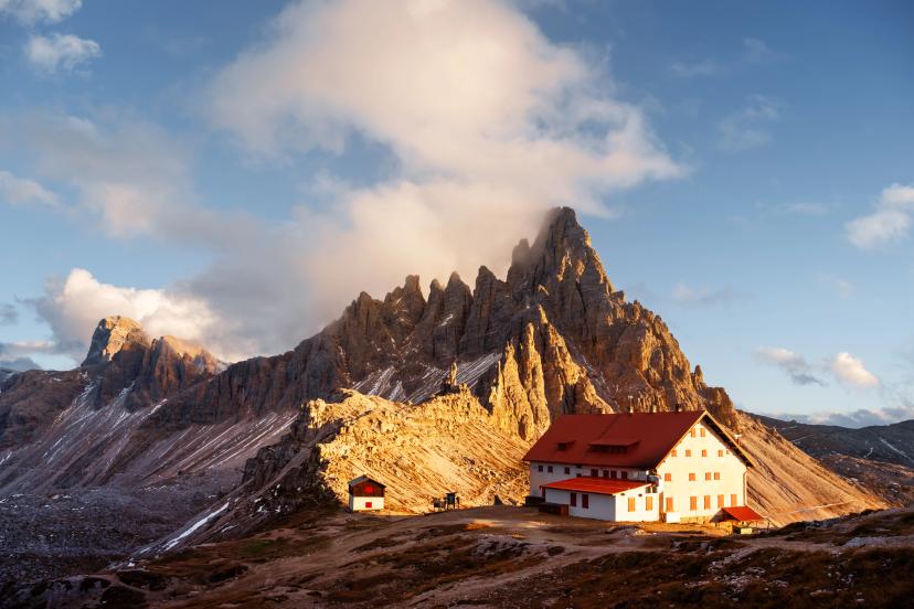
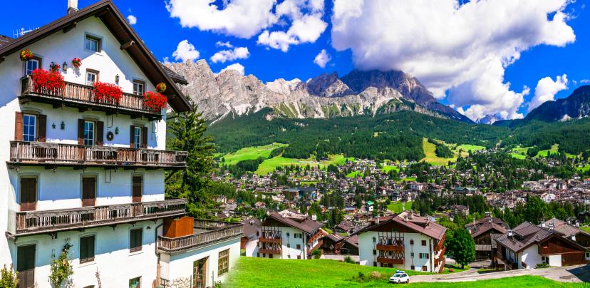
Rifugio culture: Mountain huts offer dinner (usually fixed menu with multiple courses), breakfast, and bunk accommodation. It's communal, friendly, and part of the experience. Don't expect luxury—expect authenticity and stunning locations.
Trail marking: Alta Vias follow the standard Alpine red-white-red blazes, plus specific Alta Via numbers. Most junctions are well-signed, but GPS backup is wise on less-traveled routes.
Weather considerations: Mountain weather changes quickly. Afternoon thunderstorms are common in summer. Always carry rain gear, and be prepared to adjust plans if conditions turn serious.
Need help deciding which route matches your abilities and preferences? Book a meeting with our team—we'll walk you through the options and help you make the right choice.
Our Top Recommendations
After guiding countless hikers through the Dolomites, here's what we recommend for different types of adventurers:
For First-Timers: Alta Via 1 Southern Highlights
If you're new to multi-day mountain hiking or the Dolomites, don't jump straight into the full 12-day AV1. Instead, tackle the southern highlights section from Arabba or Alleghe to Belluno.
Why this is perfect: You'll experience classic Alta Via 1 scenery—including the spectacular Civetta massif—without the commitment or early difficult sections. It's 4-6 days of magnificent hiking that leaves you wanting more (the perfect result).
How to extend: If you absolutely love it, you can easily add the central or northern sections next season, building toward the full route.
For the Complete Experience: Full Alta Via 1
The 10-12 day full traverse from Lago di Braies to Belluno remains the ultimate Dolomites adventure. You'll earn bragging rights, cross a dozen mountain groups, stay in 10+ rifugios, and accumulate memories for a lifetime.
Pacing matters: Don't rush it. The full route gives you time to adjust to the elevation, settle into the rhythm, and truly immerse yourself in mountain life.
For complete planning details, route breakdown, and what to expect each day, see our Alta Via 1 Ultimate Guide.
For Adventure Seekers: Alta Via 2
If you've already completed AV1 or similar challenging routes and you're ready to level up, Alta Via 2 is your next frontier.
What makes it special: The combination of technical challenge, remote terrain, and the Marmolada crossing creates something genuinely adventurous. This isn't a walk—it's a mountain expedition.
Preparation requirements: Via ferrata practice is essential. Physical training should be more intensive than for AV1. Mental readiness for long, exposed days matters as much as fitness.
Get the full breakdown in our Alta Via 2 Ultimate Guide before committing.
For Off-the-Beaten-Path Explorers: Alta Via 1 Hidden Corners
Want Alta Via 1's scenery with a fraction of the crowds? Our hidden corners route combines AV1's best sections with quieter parallel trails, lesser-known rifugios, and valleys most hikers skip.
Who it's for: Experienced hikers who've done research, appreciate solitude, and want to see the Dolomites beyond the Instagram highlights.
Frequently Asked Questions
Can I hike multiple Alta Vias?
Absolutely! Many hikers combine sections—for example, AV1 and AV3 link naturally, or you can do AV1 one year and return for AV2 the next. Just ensure you have the time and fitness. Then contact us and we will make it happen.Which Alta Via is hardest?
Alta Via 2 takes top billing for technical difficulty. Alta Via 10 is challenging for remoteness and navigation. Alta Via 1 is most accessible.Do I need via ferrata experience?
For Alta Via 1, no—via ferrata sections are optional alternatives. For Alta Via 2, yes—it's mandatory for several sections (in the classic version, but they can be avoided). For other routes, check specific itineraries.How much does an Alta Via cost?
Budget €60-90 per day for half-board rifugio accommodation, plus equipment, transport, and guides if applicable. Our packages include all accommodation, meals, and logistics for transparent pricing.What if I can only do part of a route?
Perfect! Most Alta Vias break naturally into sections. You can hike 3-5 days of AV1, for example, and save the rest for another trip. We offer flexible itineraries for exactly this reason.
Find Your Perfect Alta Via
There's no single "best" Alta Via—only the best one for you, right now, with your current experience and goals.
Alta Via 1 offers the perfect introduction—stunning scenery without overwhelming demands. Alta Via 2 delivers expedition-grade challenge for experienced hikers. And Alta Vias 3-10 provide specialized experiences for specific interests.
Browse our complete tour collection or contact us to find your perfect Alta Via adventure.

About this author
Ajda is our travel advisor, raised in a village surrounded by mountain peaks. Hiking entered her life early on and remains her favorite way to reconnect with nature.